LeafySpurge Spurge-A1-Jul98
LeafySpurge Spurge-A1-Jul98 — NIR2,126 points · 4000–12500 cm⁻¹
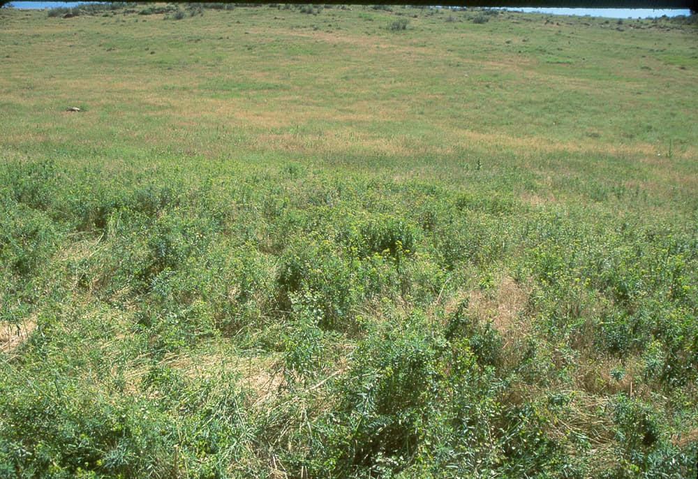
Sample photograph — USGS Spectral Library v7
Spectrum Details
- Modality
- NIR
- Category
- vegetation
- Material Type
- PLANT
- Sample ID
- Spurge-A1-Jul98
- Collection Locality
- Golden, Colorado
- Spectral Purity
- 1a2_3_4_ # 1= 0.2-3, 2= 1.5-6, 3= 6-25, 4= 20-150 microns
- Composition / XRD
- none
- Sample Description
- Average reflectance for an area of grassland invaded by the invasive plant species leafy spurge (Euphorbia esula L.). The area measured was approximately 15 meters in diameter. The leafy spurge cover was approximately 70% (estimated visually). The remainder of the rocky soil was covered by mixed native grass and litter. The spurge plants were 0.3 to 0.6 m in height. Leaves of the spurge plants were green in color. Some plants had yellow-green flower bracts present. The presence of the bracts varied greatly from plant to plant and from one area to another. The grass cover was dry, brown, and sensescent. This area (Site A) had more plants with bracts remaining on the plants compared to Site B. The spectra were collected with the head of the spectrometer pointed approximately at nadir, approximately 1 meter above the ground surface, while the operator walked through the area recording spectra. This average spectrum was computed from 33 individual recorded spectra (each recorded spectrum was an average of 30 measurements). The spectra were measured on July 10, 1998. This area of leafy spurge is situated on a southwest facing slope in an area that had been grazed by cattle. The general location is a rural area on the northern edge of the city of Golden, Colorado (GPS coordinates are 39 degrees 47.062 minutes N latitude, 105 degrees 14.425 minutes W longitude; Datum = WGS84). The specific location (Site A) of the area from which this average spectrum was computed is 25 meter NW of the given GPS coordinates. Sky conditions during the measurement were mostly clear with a few small, patchy clouds. This is the same area measured for spectra Spurge-A1-Oct97, Spurge-A1-Jun98, and Spurge-A1-Sep97. IMAGE_OF_SAMPLE:
- X Units
- cm⁻¹
- Y Units
- Absorbance
- Data Points
- 2,126
Download
Attribution
USGS Spectral Library Version 7, U.S. Geological Survey
License: Public Domain
DOI: 10.3133/ds1035Analyze in Workbench
Open this spectrum in the SpectralBench workbench for advanced analysis, peak detection, and comparison.
Open Workbench