Oiled marsh dry DWO-3-BAT-09 — NIR2,126 points · 4000–12500 cm⁻¹
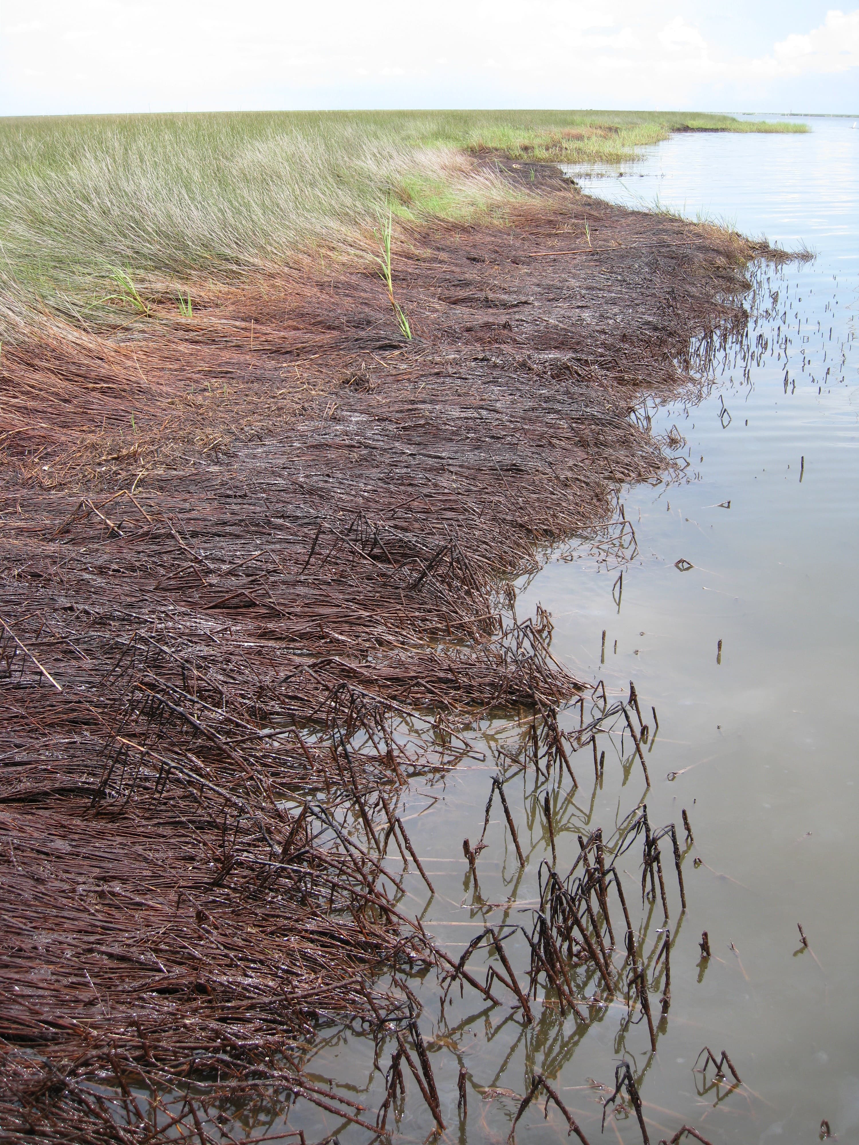
Sample photograph — USGS Spectral Library v7
Spectrum Details
- Modality
- NIR
- Category
- man-made
- Material Type
- non-photosynthetic vegetation coated with weathered oil
- Sample ID
- oil-coated and non-photosynthetic vegetation at site DWO-3-BAT-09
- Collection Locality
- Barataria Bay, Louisiana
- Spectral Purity
- 1a2_3_4_ # 1= 0.2-3, 2= 1.5-6, 3= 6-25, 4= 20-150 microns
- Sample Description
- Weathered oil from the Deepwater Horizon spill coating marsh plants. The spectrum is an average of 25 measurements made of oil-coated and oil-free Juncus roemerianus and Spartina alterniflora. The oil-free plants in the area were in a dry, non-photosynthetic state. The area measured was a 1 meter wide strip of mixed oiled and non-oiled vegetation at the interface between the black/dark brown oiled plants at the shoreline and green plants (only oiled at the base of their stems) deeper in the marsh. The spectrum was measured in the field on August 13, 2010, approximately 5 meters inland from the measurement of another area (Oiled marsh DWO-3-BAT-09) which had 100% cover of oil-coated vegetation. The reflectance spectrum has absorption features centered near 1.72 and 2.30 microns arising from C-H bonds in weathered oil. The site DWO-3-BAT-09 is described in: Kokaly, R.F., Heckman, David, Holloway, JoAnn, Piazza, Sarai, Couvillion, Brady, Steyer, G.D., Mills, Christopher, and Hoefen, T.M., 2011, Shoreline surveys of oil-impacted marsh in southern Louisiana, July to August 2010: U.S. Geological Survey Open-File Report 2011�1022, 124 p. Available at http://pubs.usgs.gov/of/2011/1022/ This spectrum, labeled as "Oiled-Dry-Marsh", was published and described in: Kokaly, R.F., Couvillion, B.R., Holloway, J.M., Roberts, D.A., Ustin, S.L., Peterson, S.H., Khanna, S., and Piazza, S.C., 2013, Spectroscopic remote sensing of the distribution and persistence of oil from the Deepwater Horizon spill in Barataria Bay marshes, Remote Sensing of Environment, Volume 129, Pages 210-230. http://dx.doi.org/10.1016/j.rse.2012.10.028 IMAGE_OF_SAMPLE:
- X Units
- cm⁻¹
- Y Units
- Absorbance
- Data Points
- 2,126
Download
Attribution
USGS Spectral Library Version 7, U.S. Geological Survey
License: Public Domain
DOI: 10.3133/ds1035Analyze in Workbench
Open this spectrum in the SpectralBench workbench for advanced analysis, peak detection, and comparison.
Open Workbench